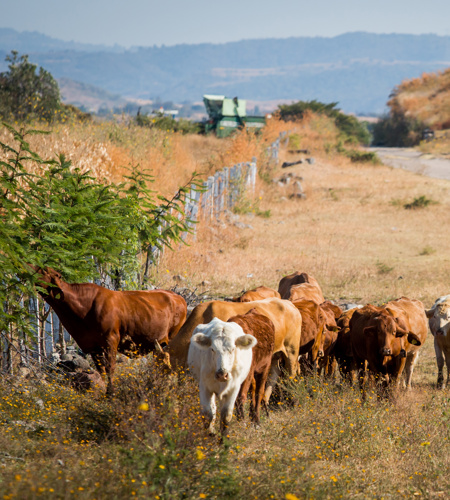
Texas is comprised of 142 million acres of private farms, ranches and forests, leading the nation in land area devoted to privately owned working lands. These lands provide substantial economic, environmental and recreational resources that benefit all Texans.

Rapid population growth is driving suburbanization, rural development and ownership fragmentation that increasingly threatens working lands. These threats result in a fundamental change in the Texas landscape, impacting:

  • rural economies,
  • food and water security and
  • conservation of natural resources.

The Texas Land Trends project monitors the status and changes in land use, ownership size and land values of working lands. Research results are published as topic-based reports through the txlandtrends.org, an award-winning interactive website. Users can also explore and query the Texas Land Trends data through the web-based mapping service. Texas Land Trends provides decision-makers and stakeholders with timely information to support the conservation and strategic planning of working lands within a spatially explicit context. Here's a preview of a few tools we've developed through the Texas Land Trends GIS project:

Data Explorer

  • This tool allows users to curate land trend data based on their area or areas of interest. Custom data queries by users generate an output of summary statistics, which demonstrate land demographic data in three primary categories: land use, land values, and ownership. These data are displayed through interactive mapping, tables, graphs, and general text to allow unique visualization of occurring changes on the selected areas of interest.


Texas Early Notification Tool (TENT)

  • This tool allows users to create custom queries based on their area or areas of interest. If the area selected intersects a military asset notification area that warrants early notification, the tool will generate an output with the notification areas and associated point of contact information. These data are displayed through interactive mapping, tables, and general text.


Readiness and Environmental Protection Integration Program (REPI)

  • This tool provides users with GIS locations of all military installations nationwide with completed REPI transactions, along with relevant information and resources for these projects such as economic data and project profile pages. Custom query feature allows users to pull REPI data for multiple installations at the local-, state-, and regional-level.


TxMAP 

  • We developed a web mapping application that allows users to view and map natural resource data, and then publish a summary report on an area of interest. TxMAP enables users, such as private landowners, to define an area to perform an intersect query based on user input of geospatial data layers. The data is grouped into categories, matching our program areas of Wildlife Conservation, Rural Land Trends, Military Sustainability and Private Land Stewardship. The tool produces a report that includes maps and relevant information for the landowner to use in property management plans.


About the Texas Land Trends Data:

The Texas A&M Natural Resources Institute’s (NRI) Texas Land Trends project informs private and public decision-makers about the status and trends of our state’s working lands through the detailed curation and combination of multiple statewide datasets. It is NRI’s policy to operate this project based on scientifically and statistically developed principles and protocols. Inherent to this policy is our necessity to maintain and protect the integrity, validity, and security of our data, analyses, and processes.

NRI has dedicated significant resources to develop the methodology used to create our Texas Land Trends database, and do not share shapefiles or raw data with external entities. However, public usability and access to this data is a cornerstone of Texas Land Trends, leading to the creation of our innovative Data Explorer tool. Users can explore specific areas of interest (e.g., counties or ecoregions) or view statewide trends, with results presented through tables, charts, graphs, and maps alongside informative text to help explain common trends. This web tool allows users to visualize the data and even download select graphics. See our About the Data page for all data sources and descriptions.


Addie Smith
addie.smith@ag.tamu.edu

Addie Smith is a geospatial analyst and program coordinator at the Texas A&M Natural Resources Institute. Using geospatial data, she examines new patterns and identifies trends to provide key information for complex Texas…

Kevin Skow
kevin.skow@ag.tamu.edu

Kevin Skow provides mapping support and serves as the lead for several projects within the institute. He conducts analysis and data management and supports other needs focused on natural resource issues.

Before joining NRI i…

Alison Lund
alison.lund@ag.tamu.edu

As a program manager for the Texas A&M Natural Resources Institute, Alison leads several initiatives spanning NRI’s programs including Private Lands & Trends and Military Land Sustainability & Policy. Her work foc…

Ross Anderson
ross.anderson@ag.tamu.edu

As an associate director for the Texas A&M Natural Resources Institute, Ross Anderson provides leadership for web and desktop application planning, development and maintenance at the institutes. He is involved with the in…

Roel Lopez
roel@tamu.edu

As director for the Texas A&M Natural Resources Institute, Dr. Roel Lopez provides leadership in the field of wildlife ecology and natural resource management. Roel works with internal and external stakeholders in develop…

Matt Crawford
matthew.crawford@ag.tamu.edu

Matt Crawford, a certified GIS professional with over two decades of experience, serves as the GIS Coordinator and has been with Texas A&M Natural Resources Institute since September 2013. Holding a master's degree in Ran…

Garrett Powers
Garrett.Powers@ag.tamu.edu

Garrett joined the Texas A&M Natural Resources Institute as a student technician in 2012, while working to earn his Bachelor of Science in Spatial Sciences that he later received in 2013.  Following his undergraduate degr…

    News

    Some landowners diversify as Texas working land declines

    The Big Bend Sentinel — Over a twenty-year period, Texas lost 2.2 million acres of working lands, with 1.2 million of those being converted to non-agricultural use in the last five years alone,  according to a new study of Texas land trends from 1997 to 2017 by Texas A&M Natural Resources Institute.

    NRI publishes Status Update and Trends of Texas Working Lands 1997-2017

    We are proud to present the long-awaited Texas Land TrendsStatus Update and Trends of Texas Working Lands 1997 - 2017  published in December 2019. Texas Land Trends reports have informed private and public landowners and decision-makers for over two decades. With this report, we are able to examine new patterns and identify trends following the release of the Census of Agriculture datasets by the U.S. Department of Agriculture (USDA) National Agricultural Statistics Service’s (NASS). These datasets provide key information for complex Texas natural resource challenges through the power of a “good map.”  The Texas Land Trends:  Status Update and Trends report is the fifth iteration and specifically describes the status and recent changes in land values, ownership size and land use of privately-owned Texas working lands. 

    New report shows changes in Texas borderlands over time

    The Madisonville Meteor—Changes in population density, rapid urbanization and rising land values have altered much of the historically rural landscape of the Texas borderlands, according to a recent Texas Land Trends report. 

    NRI releases first Conservation Easements in Texas publication

    This special series report describes the state’s current participation and growing need for land conservation easements. In this report we assess the value of all conservation easement acres in Texas within three broad categories of ecosystem services to describe the significant impact these lands have on the state's economy.

    Texas Land Trends tracks a changing state

    Is Texas a rural state? Yes. Eighty-three percent of the state’s lands are farms, ranches and forests. But it’s also an urban state. Eighty-six percent of Texans live in urban areas.


      Blog Posts

      A Natural Infrastructure Plan for the Hill Country

      The Texas Hill Country Conservation Network is proud to release the Hill Country Land, Water, Sky, and Natural Infrastructure Plan. This plan includes a shared vision for the Hill Country, collaboratively developed infographics, and objectives & strategies for achieving the Plan’s vision. 

      Results of statewide landowner survey published

      AgriLife Today — The stewards of Texas’ working lands have spoken. The data collected by the survey aids natural resource agencies in developing and implementing educational resources and programming to benefit landowners and the landscapes they steward. 

      Read the Statewide Texas Landowner Survey results

      Researchers from the Texas A&M Natural Resources Institute (NRI), in collaboration with Texas Parks and Wildlife Department and agricultural and natural resource professionals distributed the survey to better understand rural landowners and their land management objectives, challenges, concerns, and preferences.

      San Antonio Rodeo Seminar Recap

      Our director, Dr. Roel Lopez, recently had the pleasure of speaking at the Wildlife and Natural Resources Seminar at the San Antonio Stock Show and Rodeo.

      Announcing the new statewide assessment: Putting a dollar amount to Texas ecosystem services

      Promoting the long-term sustainability and stewardship of natural resources begins with a basic understanding of ecosystem services and their public benefits. Ideally, the ability to assign monetary value can illustrate the importance of their fundamental contributions to society. An analysis like this can serve to support land conservation strategies and policies to promote the conservation of open spaces and natural resources.

      What is a Conservation Easement?

      As open space land in Texas is constantly changing and repurposed to support our growing populations and urban areas, have you ever wondered what would happen if land wasn't so easily fragmented? What if the private land you own or have spent time on stayed as it is forever?

      Featured Map: Cattle trails to Texas highways

      Depicting their latest discovery, the Texas Land Trends team developed a new map series featuring the original Texas cattle trails to show how the historical cattle drive routes and supply posts have evolved into major highways and urban centers today. 

      Featured Map: Land ownership types across the U.S.

      Working lands, whether private or publicly owned, provide substantial economic, ecological, and recreational resources across the U.S. Here in Texas, we often boast of being a “private land state”, meaning the majority of the land (~95%) is held in private ownership. Many may wonder how this came to be and if other states fall under similar ownership patterns. For this new Featured Map, we briefly explore the history of land settlement across the nation and demonstrate the unique ownership landscape that exists today.

      Reboot: The Texas Land Trends Data Explorer

      Under the Texas Land Trends project, informative reports have been developed over the years to empower public and private decision-makers with the information needed to plan for the conservation of vital working lands. Public usability and access to this report data has been a cornerstone of this long-standing effort, promoting the creation of the Data Explorer tool, which was first launched in 2015.

      Fall 2020 Sourcebook: Volume 1, Issue 2

      The Fall 2020 NRI Sourcebook (V1:I2) is here, a digital collection complete with the recently published peer-reviewed scientific publications, research reports, and resources developed to support the improvement of conservation, natural resource management and private land stewardship.

      13,500 minutes of the Texas Early Notification Tool

      It’s been one year since TENT was launched and more than 450 30-minute sessions have been conducted by industry leaders, community stakeholders and military planners working collaboratively and proactively to avoid conflict.

      A new perspective on Texas phenology

      In our latest featured map, we took satellite imagery collected throughout 2019 and stitched them together in an animation to illustrate the phenological changes of vegetation across Texas.

      Beyond the fence line with Texas Ag Land Trust

      Listen in on Texas Ag Land Trust's latest podcast as TALT CEO Chad Ellis and NRI's Dr. Lopez delve into key land trend findings and what they mean for Texas’ working lands.

      A Look at Texas Agriculture and the Texas A&M AgriLife Support Network

      Texans will agree that you could never experience the full breadth of the state in one lifetime. It’s easy to identify the unique characteristics sprinkled throughout, ranging from the population composition and cultures, the native flora and fauna, and the spectacular river systems like the Red River in the north and the Rio Grande in the south. In true Texas form, you will also find a range of agricultural production strategies varying by regional differences in climate and landscape. At the Texas A&M Natural Resources Institute, we tell the story of our state’s privately-owned farms, ranches, and forests, otherwise known as working lands, which provide numerous ecological, economic and intrinsic benefits to our communities and beyond.

      Summer 2020 Sourcebook: Volume 1, Issue 1

      The Summer 2020 NRI Sourcebook (V1:I1) is here, a digital collection complete with the recently published peer-reviewed scientific publications, research reports, and resources developed to support the improvement of conservation, natural resource management and private land stewardship.

      Featured Map: Fragmentation Risk Index

      How we, as collective stakeholders in the state, balance our needs and the challenges from land-use changes will influence future outcomes for Texas’ open spaces. Where do we start?

      Some landowners diversify as Texas working land declines

      The Big Bend Sentinel — Over a twenty-year period, Texas lost 2.2 million acres of working lands, with 1.2 million of those being converted to non-agricultural use in the last five years alone,  according to a new study of Texas land trends from 1997 to 2017 by Texas A&M Natural Resources Institute.

      NRI publishes Status Update and Trends of Texas Working Lands 1997-2017

      We are proud to present the long-awaited Texas Land TrendsStatus Update and Trends of Texas Working Lands 1997 - 2017  published in December 2019. Texas Land Trends reports have informed private and public landowners and decision-makers for over two decades. With this report, we are able to examine new patterns and identify trends following the release of the Census of Agriculture datasets by the U.S. Department of Agriculture (USDA) National Agricultural Statistics Service’s (NASS). These datasets provide key information for complex Texas natural resource challenges through the power of a “good map.”  The Texas Land Trends:  Status Update and Trends report is the fifth iteration and specifically describes the status and recent changes in land values, ownership size and land use of privately-owned Texas working lands. 

      Map of the Month: Night Lights of Texas

      Through our Texas Land Trends project, we have been tracking and telling the story of rural land use changes and trends across the state for the past few decades. Using remotely sensed data, we can better illustrate these changes; especially those related to urban and energy industry growth.

      Texas Land Trends meets Real Estate

      Earlier this year, NRI was invited by the the San Antonio Board of REALTORS® (SABOR) Farm and Land Committee to present the story behind Texas Land Trends: How and Why Texas is Changing.

      The value of conservation easements: An interview with Roel Lopez

      Listen to Dr. Roel Lopez and Blair Fitzsimons, CEO of Texas Agricultural Land Trust, provide clarity on the importance of conservation easements in Texas from ensuring the public benefits remain available to helping future generations through the actions we can take now. 

      Map of the Month: Conservation Easements in Texas

      Our latest Texas Land Trends report examines conservation easements, an important tool that can complement both landowner and public needs by supporting rural economies, creating recreational opportunities. and providing intrinsic benefits.

      Map of the Month: Freshwater Mussels: Key Indicators of Ecosystem Health

      Freshwater mussels play an important role in the health of freshwater ecosystems by providing food and habitat for other aquatic species, stabilizing stream bottoms, and filtering the water in our lakes and rivers. The Rio Grande basin is home to three mussel species suffering from habitat loss and growing human populations in this area may be threatening the water systems necessary for their survival.

      Map of the Month: Bright lights and big cities: urban growth in Texas

      From scattered rural settlements to big cities, the density and distribution of people in Texas has changed dramatically over time. As "urban sprawl" continues to increase development in the outlying areas around cities, it will affect the resources, amenities, and job opportunities for the people who live there.

      Map of the Month: Wind Energy in Texas

      Texas is the largest wind energy producing state in the U.S. As the wind energy industry continues to expand, challenges of compatibility with other national priorities continue to be a consideration—including military training. 

      A Story Map: Habitat Requirements of Texas Quails

      A Texas Land Trends Story Map: Texas is home to four species of quails: Northern Bobwhite, Scaled Quail, Gambel’s Quail, and Montezuma Quail. Many Texans fondly recall experiences with quail, whether they were hunting or watching them, or just listening to their songs. Despite the interest in these quail species, their overall abundance, especially northern bobwhites, have declined over the past few decades. Recent research efforts seek to determine what factors have and continue to contribute to the decline of quail in Texas. 

      Map of the Month: Wildlife management land use acres

      While ag tax evaluations traditionally involve practices such as haying, cropping, grazing and livestock, the state added a wildlife management use component in 1995. This non-traditional approach to preserving open space lands and their values has gained momentum in the past two decades, as the total number of acres enrolled has risen from 93K in 1997 to 3.2M in 2012. So how do you qualify and what is the process to switch from a traditional ag use property to wildlife management use? 

        Related Projects