

Featured Map: Out of this world imagery for natural resources management
What do natural resources professionals have in common with rocket scientists? More than you might think. Spacecraft-based cameras that orbit the globe have been providing images that guide natural resource management for decades.
The NASA/USGS Landsat Program emerged from an initiative to “provide us with the opportunity to collect valuable resource data and use it to improve the quality of our environment”(Landsat Satellite Missions | U.S. Geological Survey (usgs.gov)). Over the past 50 years, the program has launched a total of nine satellites to collect images of Earth’s surface. The two that are still operational today collect about 1,500 images per day (that cover almost 12 billion acres), revisiting the same location every 8 days!
Using remote sensing techniques with Landsat imagery, we gain information about habitat at a rate and scale that is simply not feasible through field observations alone. We can use imagery to assess habitat quality and quantity, perform change detection, and analyze potential threats and impacts to habitat (e.g., effects of disease, land cover conversion, natural disasters, drought, etc.). This insight into current and past conditions is particularly important in studying and managing for species of conservation concern, and ultimately helps us be better land and wildlife stewards by informing habitat management needs and plans.
Landsat gives us a more detailed view of our world with each new satellite. Let’s look at some examples of how Landsat images have improved over the course of the program.
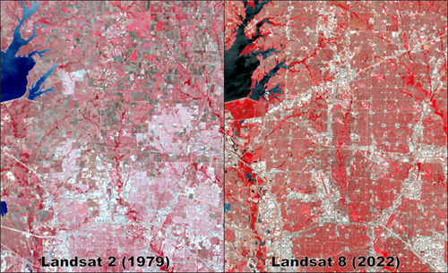
In this first set of images showing the vast expansion of development north of Dallas, you’ll notice the Landsat 8 image (right) is significantly sharper than Landsat 2 (left). This improved resolution helps us see features in greater detail so we can more accurately identify and locate them.
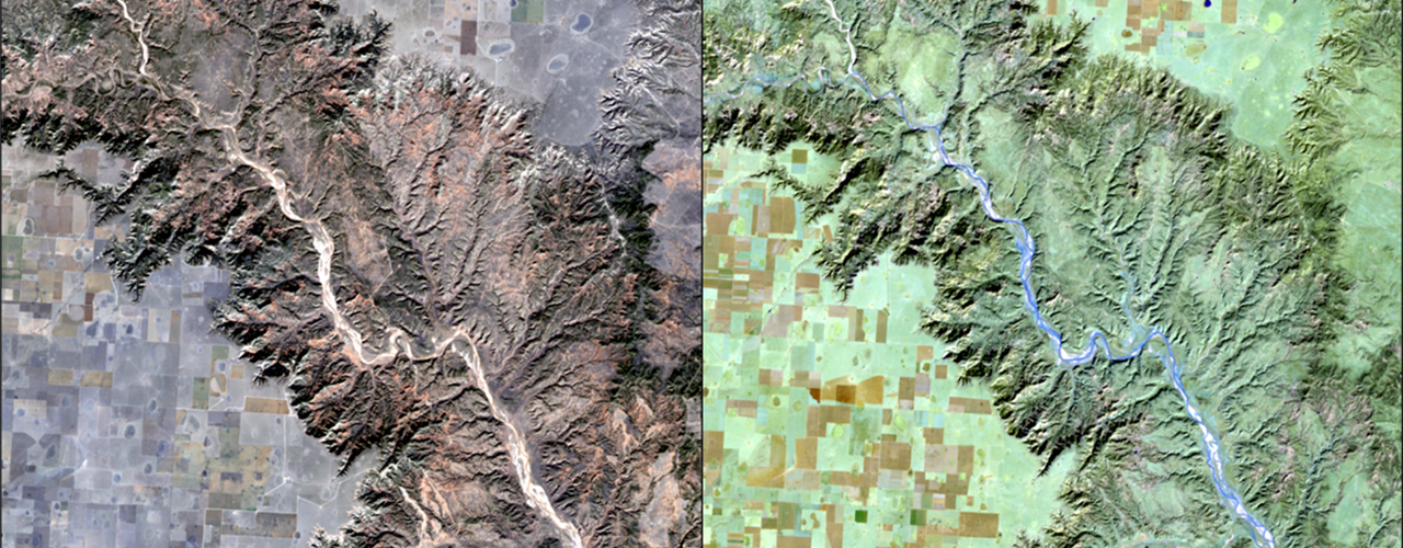
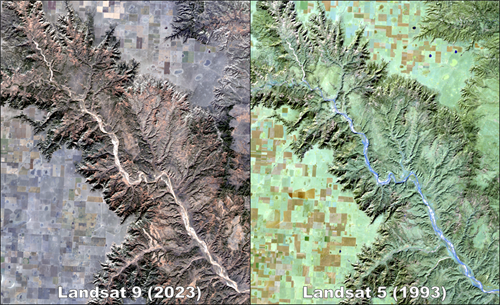
Newer Landsat satellites acquire images in more parts of the light spectrum. A specific range of wavelengths is captured in separate image bands. Beginning with Landsat 4, these additional bands give us a “natural color” image (left), as the human eye sees Earth’s surface. We can use different band combinations to enhance specific features in the image, such as surface water in Palo Duro Canyon (right). Current Landsat satellites collect six bands useful for vegetation analysis, allowing better differentiation of vegetation species and condition - crucial for identifying wildlife habitat.
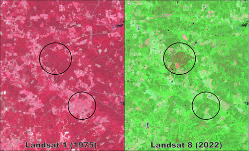
In this final example, we see how Landsat detects changes in the East Texas landscape, identifying both when and where changes happened. Circled areas show where pine trees were harvested and replanted between 1975 (left) and 2022 (right). Recently planted trees are very apparent in the Landsat 8 image (right), using a band combination conducive to visualizing vegetation types and soil moisture. Analyzing the full catalog of Landsat images in this location is helpful for estimating forest stand age and quantifying landscape change trends – both of which impact management for species of conservation concern.
So, there you have it - natural resource professionals can use this incredible product of rocket scientists to be better stewards of land and wildlife. It’s amazing what we continue to learn about our planet using images captured from over 400 miles away!
--
The Texas A&M Natural Resources Institute grants permission for authors, readers and third parties to reproduce and republish materials from its blogs, publications and online products through permission requests to NRI Communications at nri@tamu.edu. This includes the use of figures, maps, photography and video media. If you have questions about permissions, please contact Brittany Wegner.
Share this post
Authors

Amanda provides geospatial analysis and mapping support for various institute projects. Her primary focus is incorporating spatial analysis and remote sensing techniques to identify and characterize suitable habitat for speci…